Showing posts with label geography. Show all posts

Monday, July 28, 2014

Around Town: Bartlett Lake

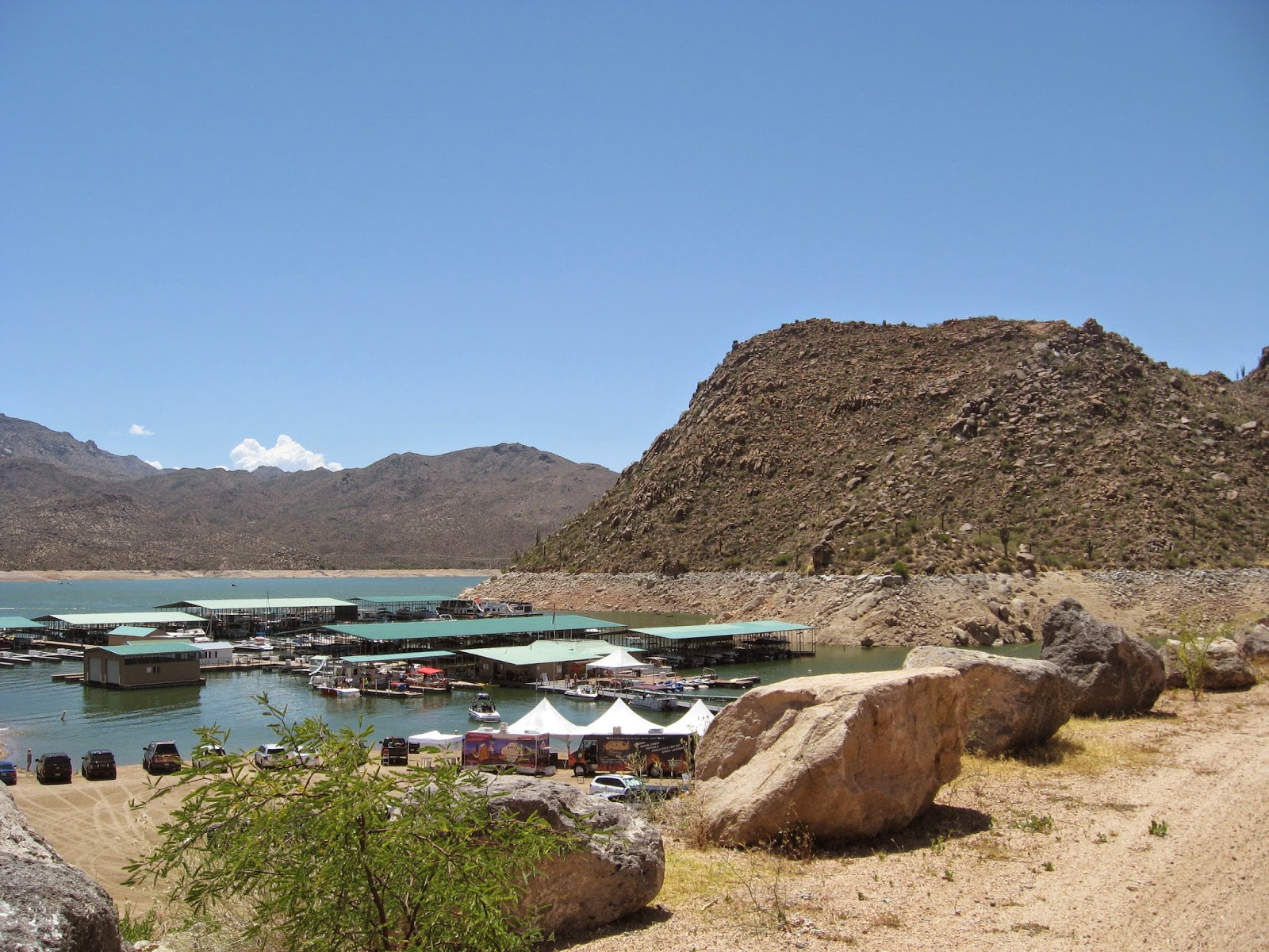
Before temperatures hit the triple digits, we wanted to explore some of the water recreation near the Phoenix area. Many newcomers to the desert are shocked to hear that there are multiple options for getting on a boat in the desert - Lake Pleasant, Lake Roosevelt, Canyon Lake, Saguaro Lake, Lake Bartlett - just to name a few. For this trip, we were looking for remote camping and Stand Up Paddle Boarding (SUP)... and you can't beat the price of National Forest camping (free)!

Despite some difficulty navigating the roads of Tonto National Forest, we found a secluded campsite under the cover of darkness. We pulled into a car camping spot and set up a tent on soft sand, within earshot of a gurgling stream.

The next morning, we broke camp and headed down the road toward Bartlett Lake.

We were outfitted with our SUP gear, and hit the water!

A few hours gave us enough time to tour the perimeter, beach up opposite the marina, and have a little fun in the wake of a few motor boats. We took turns using our GoPro to capture photos and video hands-free.

A quick Wikipedia search revealed that Bartlett Lake is technically a reservoir, which was created by damming the Verde River in the late 1930s. It's neighbor to the north is the Horseshoe Reservoir, also on Tonto National Forest land.

For those new to SUP, we decided to demonstrate the surprisingly stable nature of these boards:


We were pleasantly surprised by how empty the lake and marina were, despite it being Memorial Day weekend! Our theory is that most folks head to more well-known spots like Lake Pleasant. Bartlett Lake boasts that it is "Arizona's Best Kept Secret," and we'll have to agree!


Friday, July 25, 2014

Grand Canyon Revisited

You may recall a previous post about a scouting trip for a future potential field trip to the Grand Canyon. Our team of 4th grade teachers and an incredibly supportive principal were able to make it happen!

First, a recap by the numbers:

149 - 4th grade students and parents in attendance
6 - teachers/staff
3 - days spent at the Grand Canyon National Park (South Rim)
2 - charter buses
4 - A.M. wake-up call to watch the sunrise on our final day

The field trip was a great success, but there are always lessons to learn and ways to improve. There are many things we will try to repeat for next year's trip, and there are a few things we'd change and recommend to others considering this field trip.

Successes:
  • NPS Travelin' Trunk Program: We reserved a box of materials about Human History of the Grand Canyon before our trip. This piqued students' excitement, and gave them prior knowledge to access once we arrived.
  • Keeping a full schedule (and opting not to include a quiet/nap time) - Any unstructured or idle time almost always guarantees mischief!
  • Visiting other areas of interest on our way, including Sunset Crater (as mentioned in a previous blog post) and...
 Montezuma Castle.
  • Watching sunrise on our final day - This was a controversial decision, mostly because the sun rises so early in May. We decided to make it optional, and were overwhelmed when nearly our entire group helped each other wake up, walk silently, and snuggle together to watch a glorious sunrise! 

  • Reserving Ranger programs - The specific educational Ranger programs for school groups are FREE and align with state content standards. The Rangers are excellent teachers, too!
  • We used colored handkerchiefs to identify each chaperone group. This was helpful for quick head-counts for both teachers and chaperones. Students could tie them anywhere that was visible, which also gave them a chance to express themselves in a fun way.
  • Preparing student journals for the trip - We created activities/questions that had to be answered about our route and stops along the way. We also included the packet that was provided to accompany the Ranger programs.
  • Scavenger Hunt - There is so much to see at the Grand Canyon, and it is nearly impossible to see it all in one short trip. We included all the various historical and educational sites along the South Rim (with questions and info from the NPS website) in student journals. Groups could then decide which locations were most interesting (and feasible). Some groups even got to every stop! Afterwards, students from different groups could discuss what they saw and learned with others.
  • Chaperone committees - We couldn't have made the trip happen without lots of parent support. We had parents serve on committees for equipment, food, and safety to assist before, during, and after the trip.
Changes/recommendations:
  • Talk with campers about quiet hours before arriving - It's important to keep our camp neighbors and Rangers happy when we are such a large and noticeable group.
  • Call ahead to discuss any plans to use the free shuttle buses. The park personnel were incredibly accommodating as soon as they saw 150+ visitors crossing the street to catch a bus for sunset. They ran at least one extra bus every day we were there just for us! I'm sure they'd appreciate a little more advance notice next time.
The successes clearly outweigh the changes, and we received lots of positive feedback from students and parents alike. We saw our entire 4th grade community come a little closer together for this trip, and a lot of fun was had by all. As for the teachers/staff, we feel a lot more confident about planning next year's excursion!


Thursday, July 17, 2014

Around Town: Camelback Mountain

To continue our meandering closer to home, I set out to hike the popular Camelback Mountain. A year and a half ago, we set out to hike the less intense Cholla Trail with family, but ran out of time and and had to turn back before reaching the summit. This time, I would be hiking the more intense (and more crowded) Echo Canyon Trail.

ClimbCamelback.com describes Echo Canyon pretty succinctly:
This trail is an intense and difficult anaerobic hike the entire 1.2 miles to the summit. It ascends 1,280 ft, from 1,424 ft above sea level to 2,704 ft.

It was a warm spring day, and many folks were eager to take advantage of it. If you're looking to drive to the trail head, I suggest arriving early. Otherwise, be prepared to do some circles around the small parking lot, as it is usually full by mid-morning. Easier parking can be found on the Cholla Trail entrance.

This is definitely not a secluded or quiet hike, but it has beautiful views of the valley the whole way. The Echo Canyon Trail was recently renovated, and re-opened earlier this year. This video shows a few of the changes, and highlights a few of the views:


A few of my photos from the hike:

Saguaros were already in bloom!

Ridge views looking east on the steep trail up

Looking north from a false summit

Red sandstone of the desert valley


Panoramic views from the summit (1 of 4)

2 of 4

3 of 4

4 of 4

On the way down, we found a few critters who agreed to pose for a photo shoot.


Friday, July 11, 2014

Around Town: Fountain Hills

This year, we did some meandering a little closer to home. In February, we were drawn to the town of Fountain Hills for their annual "Love in the Hills" event to renew our vows on Valentine's Day. It's an adorable town with an interesting history.


Our first stop was the River of Time Museum, where we received a personal tour of the area's geologic and human history. It's a small museum, and easy to miss (tucked away behind the library). If you're ever in the area, we highly recommend a short visit! Our docent went into great detail about the role of water throughout Arizona's history, right up to the planned community of Fountain Hills in the 1970s.


  So, why name a desert town after a fountain in the desert? It was built as a tourist attraction, holding the record for tallest fountain in the world for over ten years, sending water 300-561 feet in the air (depending on how many of three 600 horsepower pumps are being used). You can watch it live for yourself on the town's fountain webcam.

Fountain Hills prides itself on the variety of art work displayed throughout the town.

After our tour, we celebrated our marriage and renewed our vows with hundreds of other couples (Click here to see the official video of the event).


We ended the evening with tapas at Sofrita. If you ever find yourself in Fountain Hills, we highly recommend the bruschetta!